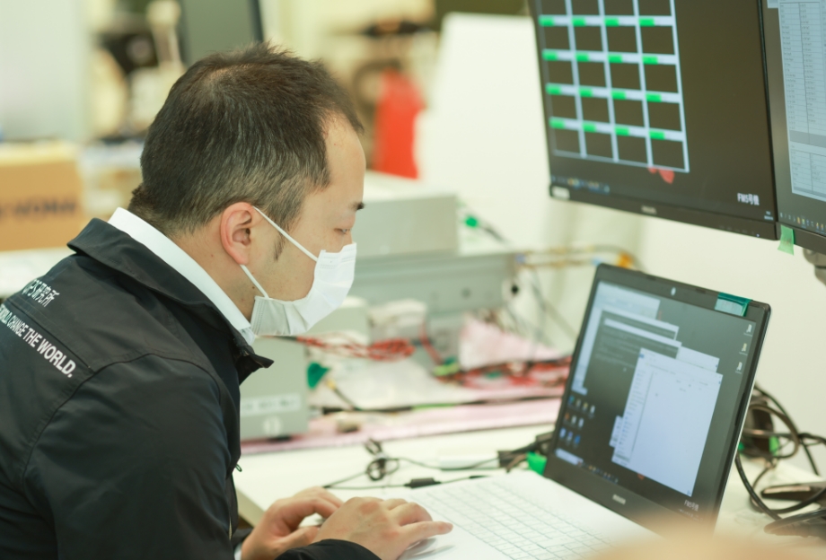
Project
The embodiment of pioneering technology for the future.
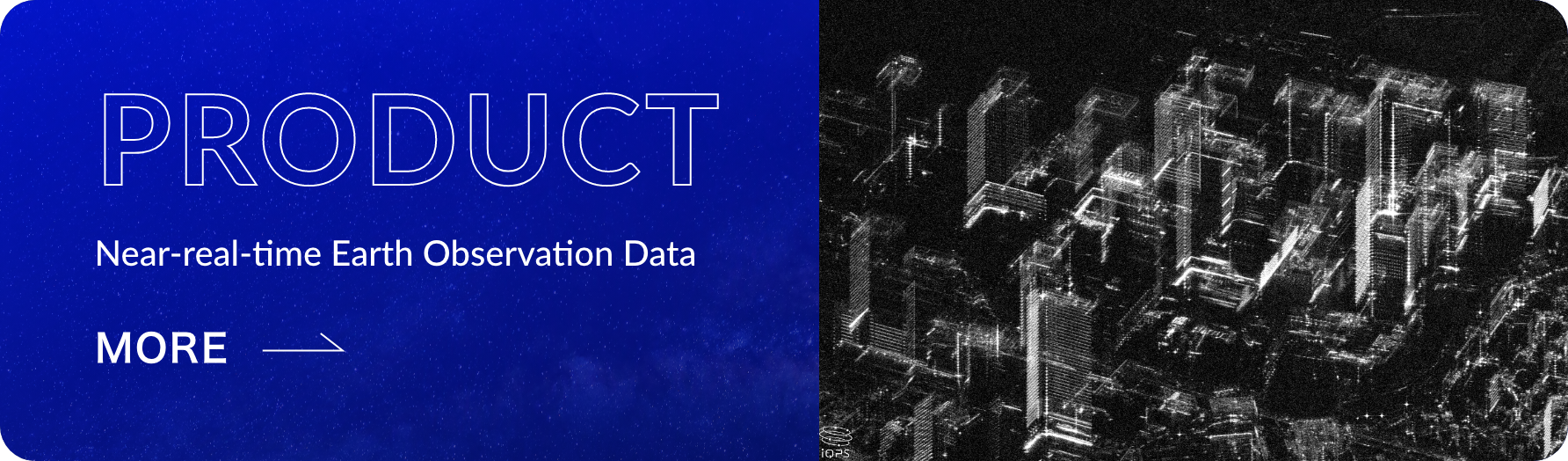
QPS-SAR PROJECTNear-Real-Time Earth Observation
by Small SAR Satellite Constellation
Features of SAR Satellite
Conventional satellites
cannot obtain
demanded data in real time
Most of the earth observation satellites currently in operation use camera (optical sensor) to take images of the Earth.
However, with current optical sensor technology, it is impossible to take pictures at night and/or in bad weather.
Considering the fact that almost 75% of the Earth's surface is always in such conditions, the services provided by conventional satellites are far from being true Earth observations.
We need satellites capable of observing the earth all day, all night, in any weather.
SAR realizes day-and-night and weather-independent observation
To solve this problems, SAR (Synthetic Aperture Radar) technology drew our attention.
However, existing SAR satellites generally weigh as much as 1,000 or 2,000 kg and thus require huge antenna and a significant amount of electricity.
Additionally, it is necessary to launch a large number of satellites in order to have a satellite always flying over the observation point, which entails substantial costs and efforts.
Types of Observation Satellite
Satellites come in various types, such as Earth observation satellites, communication satellites, positioning satellites, and scientific satellites. The information transmitted from these satellites serves us in our daily lives through weather forecasts, television broadcasts, GPS, and other applications.
Among them, Earth observation satellites consist of two types: optical-based satellites and Synthetic Aperture Radar (SAR) satellites. Most of them are optical, which use the same principle as cameras to observe the Earth, but cannot take images at night when there is no light and/or in bad weather covered by clouds.
On the other hand, SAR satellites utilize radar to emit radio waves towards the Earth's surface and receive the reflected radio waves to observe information about the Earth's surface. By measuring the phase difference of the reflected radio waves from objects on the Earth's surface, and generate images based on this phase information. Therefore, SAR satellites are capable of observing the Earth's surface independent of weather conditions or time of day.
However, it was previously believed that miniaturization of SAR satellites was deemed impossible due to the longer wavelength of the radio waves used, as compared to visible light, necessitating a large antenna and substantial power consumption to achieve adequate resolution.
|
Sunny |
Cloudy |
Rainy |
Night |
|
|---|---|---|---|---|
| Optical Camera/Sensor | ||||
| SARSynthetic Aperture Radar |
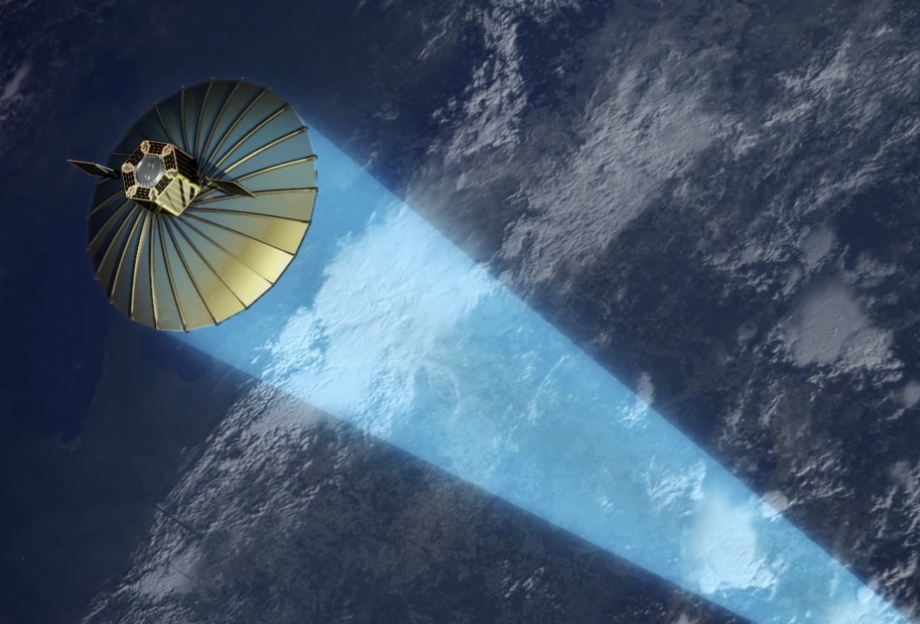
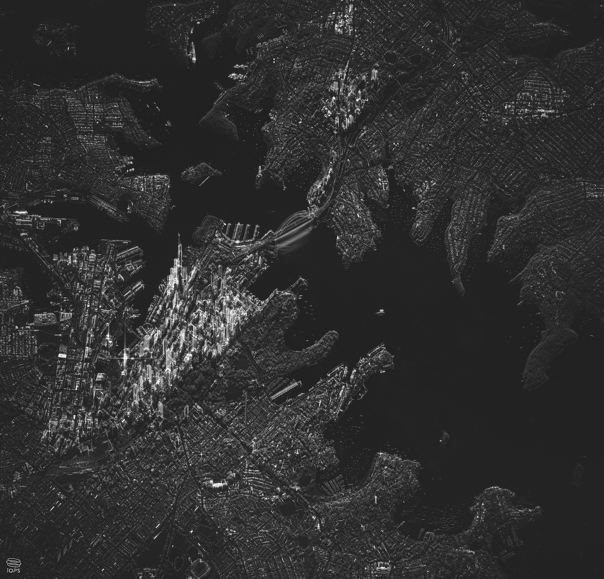
A world-class high resolution small SAR satellite in the 100 kg range
Against this background, we succeeded in developing a large antenna that is ultra-lightweight, has highly-foldability, and can be deployed in orbit. As a result, we have achieved an innovation that surpasses common sense: a satellite with a high resolution of less than one meter, yet weighing only one-twentieth the mass of conventional satellites in the 100 kg range and costing approx. one-hundredth as much as conventional satellites.
This is the QPS-SAR, the world-class high-resolution small SAR satellite in the 100 kg range.
Development Story of iQPS Satellite Antenna
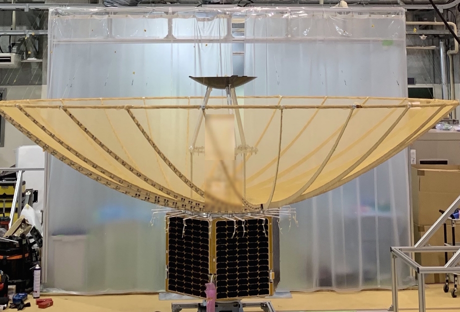
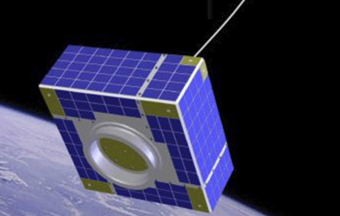
To achieve the miniaturization of SAR satellite, iQPS has created a breakthrough solution in the form of a highly foldability and ultra-lightweight large antenna (patented) that can be mounted on a small satellite.
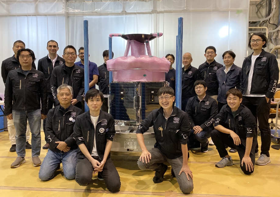
It is a large antenna with a diameter of 3.6 m, which can be folded down to a compact size of approx. 80 cm in diameter and 15 cm in height.
Upon being launched into space, it will use the force of the spring to expand into a beautiful bowl shape without the slightest slack and will be able to emit powerful radio waves.
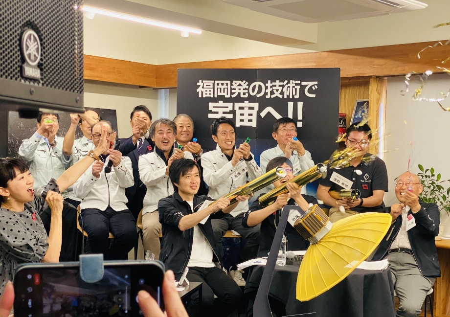
The ribs of the antenna are manufactured by "Minekatsu Kohki Co., Ltd", a spring manufacturer located in Itoshima City, the other structural parts fabrication and assembly are carried out in collaboration with "enjin Space Engineering Team (e-SET)" operating in the Chikugo region, and the sewing of the metal mesh is performed by "Kanekura kk" in Okawa City.
All of these companies are located in Fukuoka Prefecture, and it is through the integration of various technologies centered around them that this antenna has been successfully developed and completed.
For the development of this innovative and a groundbreaking antenna, we created over 100 prototypes and conducted hundreds of tests, ultimately achieving success.
Satellite constellation enables SAR images to be observed almost anywhere on Earth within an average of 10 minutes or less
QPS-SAR can observe the necessary points when needed, even at night and/or in bad weather conditions.
Therefore, by putting three satellites into one orbit and surrounding the earth in twelve different orbits, and construct a constellation with 36 satellites, it is possible to observe almost any location in the world within an average of 10 minutes, and to make a fixed-point observation of specific regions on average once every 10 minutes.
Furthermore, QPS-SAR is equipped state-of-the-art technologies, such as in-orbit image generator* and inter-satellite communication system*, which allow for rapid data transmission and delivery after observation. (*installed on our 3rd Satellite and onward)
This will make it possible to collect continuous images as data, and to accumulate data not only on "Stationary Objects” such as land and buildings, but also on "Moving Objects" such as vehicles, ships, and even livestock and people flow.
Pioneering the Future with Valuable Data
The data collected by QPS-SAR has the power to significantly transform the future. By utilizing “Moving Objects” data, we can discover new economic values, contribute to building safe and secure cities, and predict the future value of crops and the economic outlook of countries and regions when combined with weather data, market data, and economic data. Its potential is limitless. Furthermore, by combining the valuable, Near-Real-Time data generated by QPS-SAR with AI, an advanced future becomes visible.
Swiftly check the situation in case of emergency
As a disaster-prone country, Japan constantly faces risks such as earthquakes, typhoons, heavy rainfall, floods, volcanic eruptions, and more. If a disaster should occur, it is not always during the daylight hours, and of course it is not always on a clear day. Especially in the case of typhoons or heavy rainfall, the weather conditions are so bad that conventional optical satellites cannot capture images of the ground surface because they are blocked by thick cloud cover. it is also not easy to fly an airplane or drone to check the situation.
In such a situation, if several QPS-SARs, which can observe the earth's surface that penetrate through clouds and plumes, were flying around the earth, it would be possible to quickly assess the situation 24 hours a day, regardless of weather conditions.
The insights made possible by QPS-SAR

Visualizing the movement of “Moving Object”, such as vehicles, vessels, cattle and other
- ・Analyzing the movements and numbers of moving objects to determine the true value of land and buildings
- ・Examining the navigation status of vessels to analyze efficient and safe routes
- ・Analyze behavior limited to specific vehicles
- ・Supporting efficient livestock grazing management by monitoring pasture conditions and animal movement.
- ・Visualization of differences in people flow and economic conditions when the same event is held at locations A and B

Forecasting future scenarios by combining SAR data with climate data, market data, and economic data, among others
- ・Forecasting the economy of a country or region based on traffic conditions
- ・Estimating the value of futures market based on the growth status of corn
- ・Estimating the taste and future value of wine based on the growth condition of grapes
- ・Establish a citywide security system in conjunction with store cameras
- ・Supporting the realization of autonomous driving including the prediction of optimal routes and hazards based on the accumulation of human and vehicle behavior patterns and changes in buildings
Please click here for more information on SAR data provision services
SAR Satellite developed by iQPS
QPS-SAR has achieved enhanced performance and functionality from its technology demonstration satellites,
QPS-SAR-1 and -2. Currently, iQPS is gearing up to establish the capability for mass production
of improved satellites for constellation construction.
Antenna
The antenna folds up to 80 cm dia. at launch and unfolds to 3.6 m dia. in orbit. Since our 3rd satellite, the accuracy of the antenna and the performance of the radar system have been improved to enable higher resolution and higher quality imaging.
Point: Since 3rd satellite, the number of ribs on the antenna has been increased to make even more beautiful mirror surface with no sagging, resulting in a more powerful radio waves than previous designs. As a result, we have achieved successful image acquisition with a resolution of 46cm.
Observation Mode
QPS-SAR has two observation modes: the wide-area coverage "Stripmap Mode" and the high-resolution focused "Spotlight Mode".
The former enables wide-area observations with a resolution of 1.8 m. The latter allows for local observations with a resolution of less than 50 cm.
*Please inquire for more information regarding the available sizes for sale.
FLIP / Fast L1 Processor
The in-orbit image generator, FLIP converts the vast amount of raw data into images in the satellite immediately after the observation. As a result, the amount of downlink from the satellite to the ground can be significantly reduced. Furthermore, in combination with AI, the required information can be extracted quickly and delivered to the ground promptly.
*JAXA and Alouette Technology Inc. jointly developed
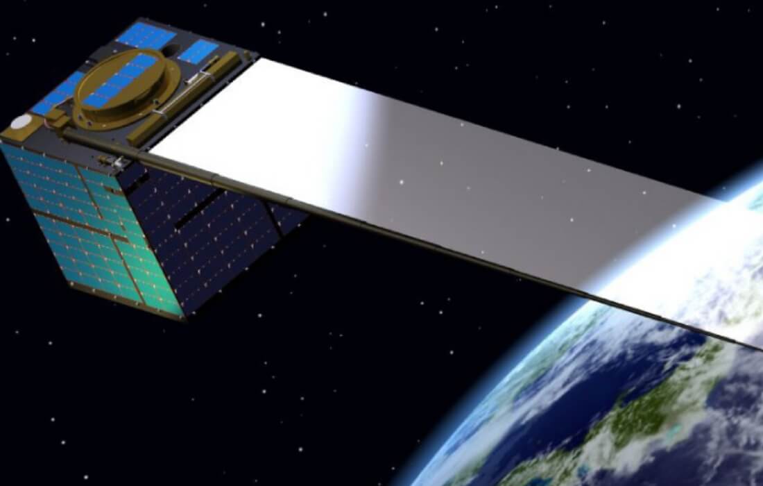
Electrically propulsion thruster
Perform orbit maintenance and deorbit at the end of the mission
Inter-satellite communication
Inter-satellite communication systems using geostationary orbit satellites can be used to uplink tasks to the satellite more quickly and to downlink images generated in orbit to the ground in a timely manner.
Satellite Design
Due to our in-house management of the design, manufacturing, and assembly, of all bus sections, we can quickly and flexibly upgrade the internals and install new equipment and sensors to suit the mission and situation.
The presence of numerous partner companies within a 50-kilometer radius, each possessing abundant expertise and advanced technologies, serves as a significant strength for us in achieving development with a sense of speed.
Solar Array Panel
Because of the optimally positioned solar panels, QPS-SAR achieves high power output and capacity, enabling efficient and long-lasting high-resolution observation.
Launch Report
-
QPS-SAR-1
“IZANAGI”
Dec. 11, 2019 -
QPS-SAR-2
“IZANAMI”
Jan. 25, 2021
-
QPS-SAR-3
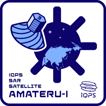
“AMATERU-I”
Oct. 12, 2022 -
QPS-SAR-4
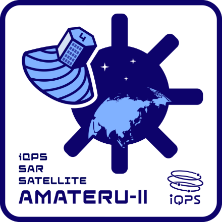
“AMATERU-II”
Oct. 12, 2022 -

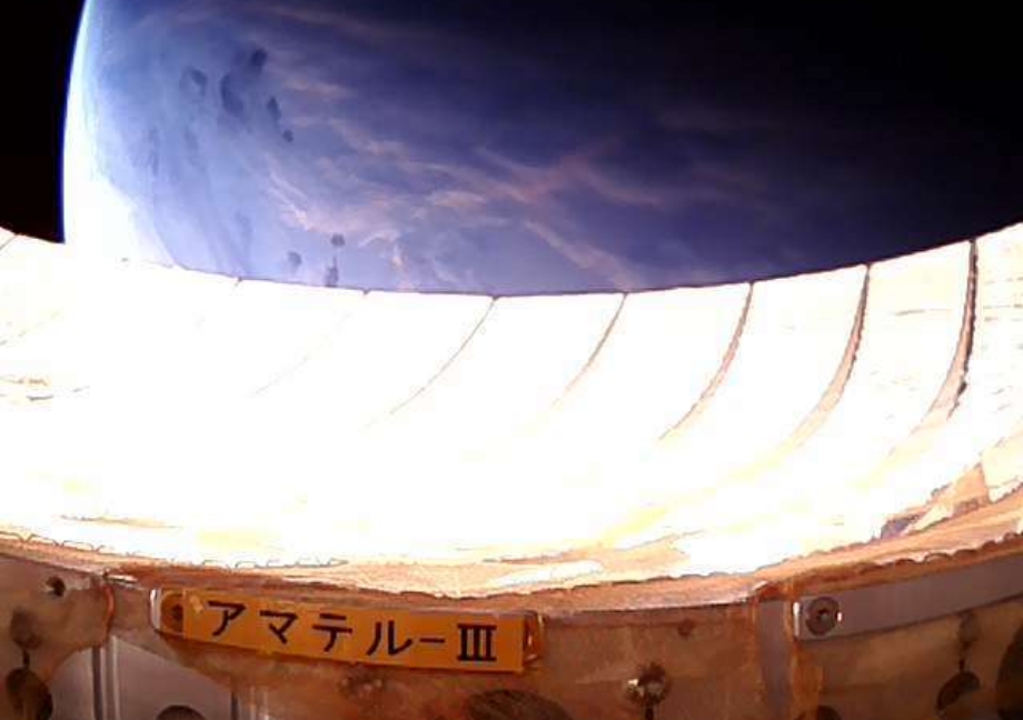
QPS-SAR-6
“AMATERU-III”
Jun. 13, 2023 -

QPS-SAR-5
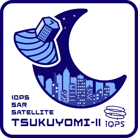
“TSUKUYOMI-I”
Dec. 15, 2023 -
QPS-SAR-7
“TSUKUYOMI-II”
Apr. 8, 2024 -
QPS-SAR-8
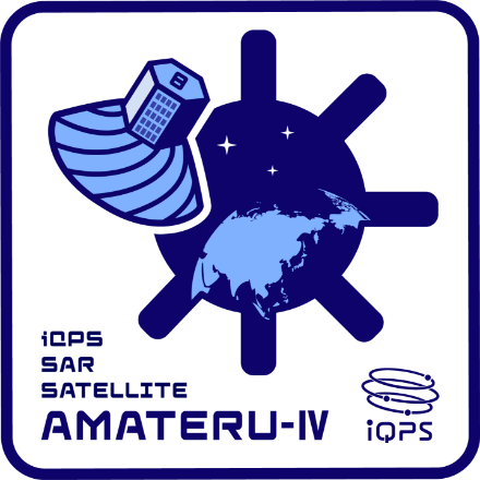
“AMATERU-IV”
Aug. 17, 2024 -
QPS-SAR-9
“SUSANOO-I”
Mar. 15, 2025 -
QPS-SAR-10
“WADATSUMI-I”
May. 17, 2025 -

QPS-SAR-11
“YAMATSUMI-I”
Jun. 12, 2025 -
QPS-SAR-12
“KUSHINADA-I”
Aug. 5, 2025 -
QPS-SAR-14
“YACHIHOKO-I”
Nov. 6, 2025 -
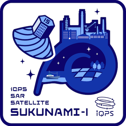
QPS-SAR-15
“SUKUNAMI-I”
Dec. 21, 2025
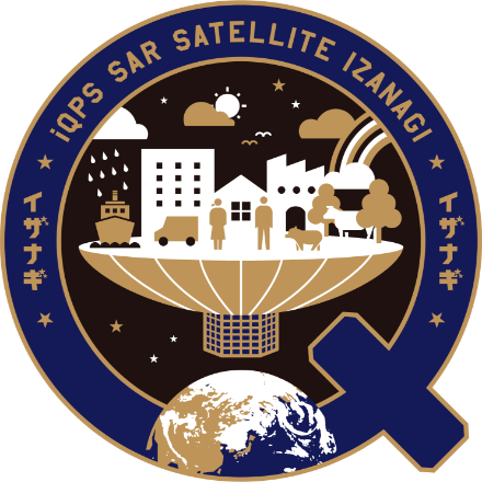
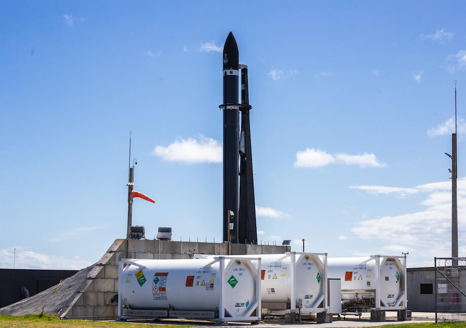
Launched in December 2019QPS-SAR-1 “IZANAGI”
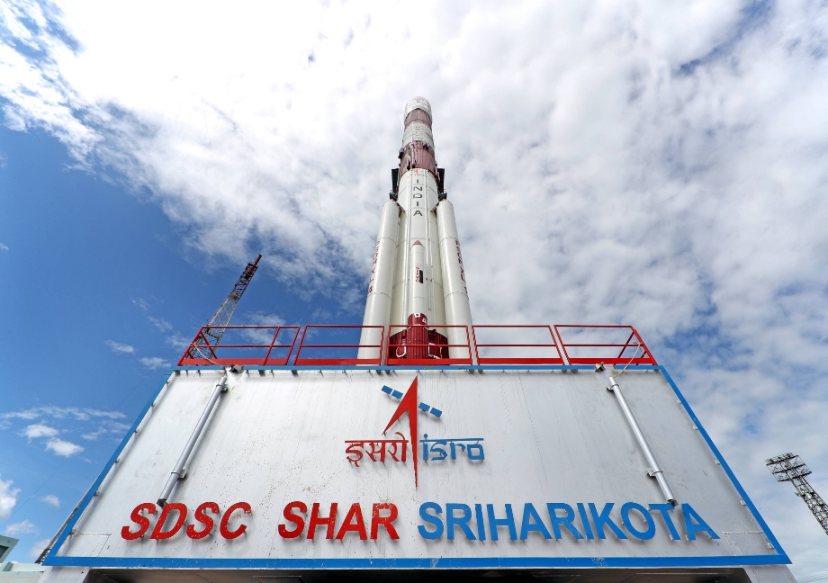
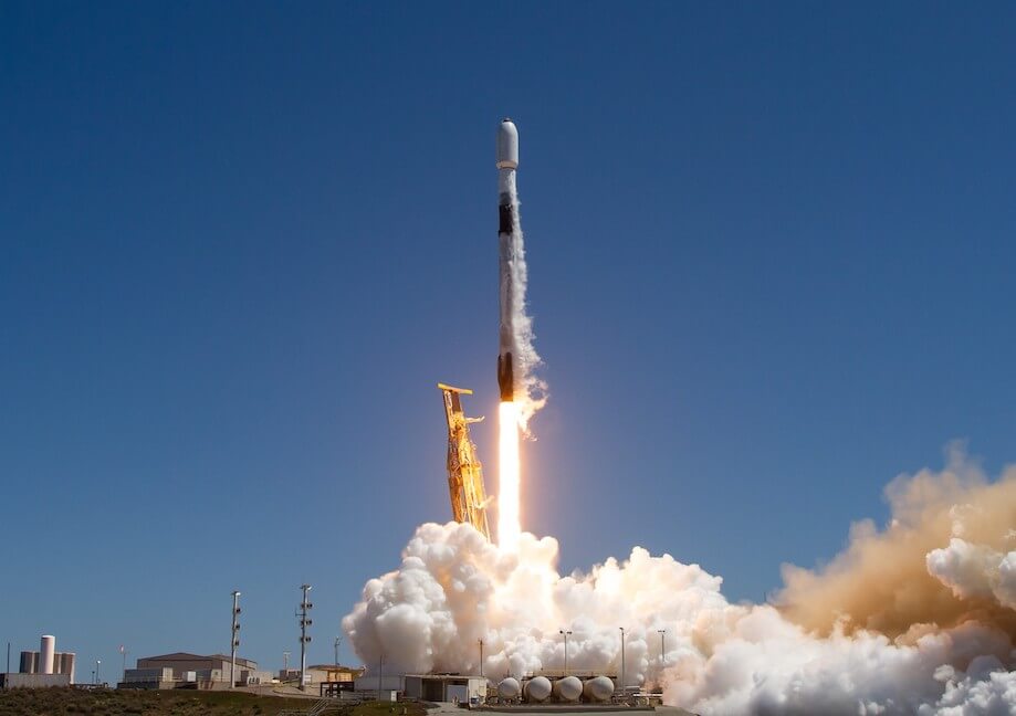
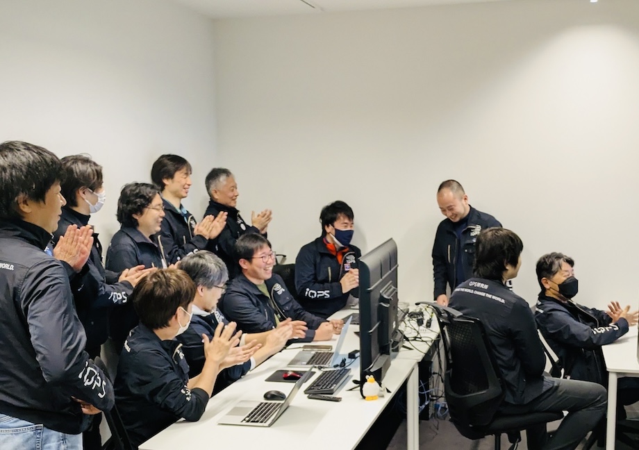
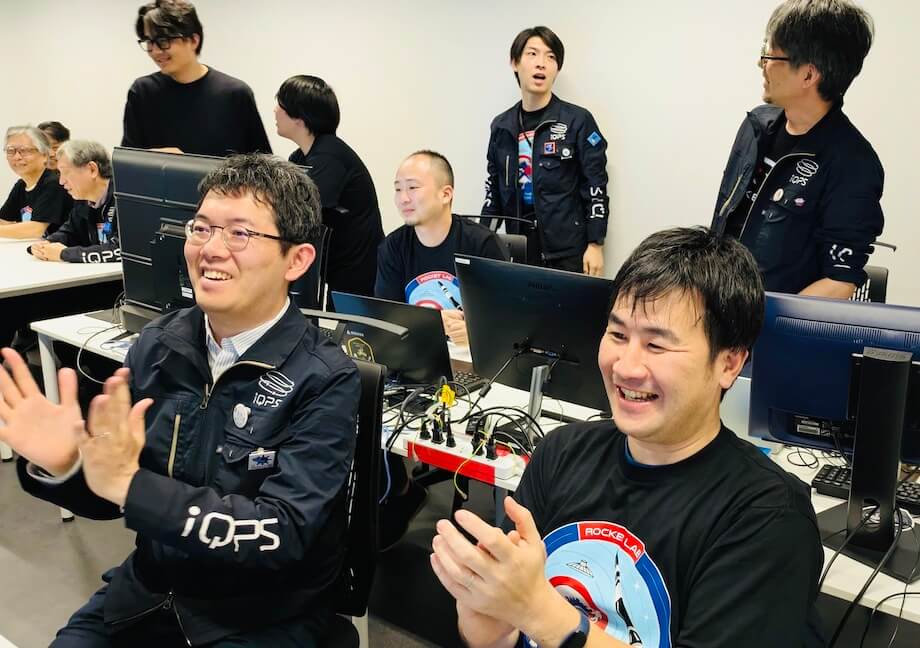
Japan's first small SAR satellite in the 100 kg range, QPS-SAR-1, named IZANAGI, was successfully launched at 18:55 on December 11, 2019 (JST), by PSLV from Satish Dhawan Space Centre in India, ISRO. On the day of the launch, a public viewing event was held at the lobby of Fukuoka Prefectural Government Office, where over 500 people in attendance to support the event.
In the early morning of December 12, the day following the launch, succeeded in the first contact between IZANAGI and the ground station, and on December 16, successfully unfold the antenna in orbit, as the satellite's key component. Subsequently, on December 18, the utilization of SAR capabilities commenced. IZANAGI, which was filled with many first attempts, was able to confirm a 95% success rate in satellite functionality. However, a partial malfunction was discovered, and unfortunately, it did not lead to the imaging of data, as the final step. We used this experience as feedback to improve next satellite.
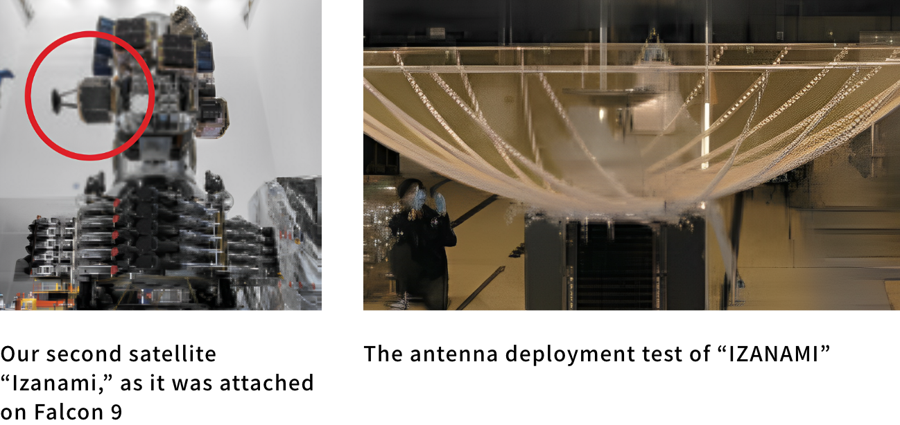
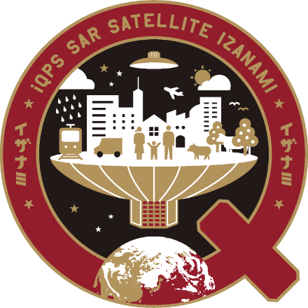
Launched in January 2021QPS-SAR-2 “IZANAMI”
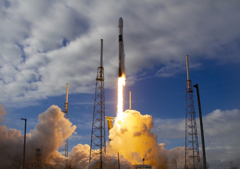
QPS-SAR-2 "IZANAMI," which underwent improvements based on the results of the QPS-SAR-1 "IZANAGI", was successfully launched from Cape Canaveral Air Force Station by SpaceX's Falcon 9 rocket at 0:00 on January 25, 2021 (JST) and deployed at an altitude of approx. 525km. Due to the impact of the global COVID-19 pandemic, an online public viewing was held at the time of the launch. Despite the late night, more than 800 people watched the event, which was covered by many newspapers, TV and web articles.
On January 25, the day after liftoff, we successfully established the first communication with IZANAMI. Then, on January 30, the antenna was deployed in orbit, after which the satellite continued to make adjustments, and finally, on March 3, we achieved the long-awaited milestone of acquiring the first light image. Furthermore, on May 13, we achieved another significant feat by successfully high resolution and high definition observing, with a resolution as fine as 70cm, by a small SAR satellite for the first time in Japan.
Launched in October 2022QPS-SAR-3 “AMATERU-I”
QPS-SAR-4 “AMATERU-II”
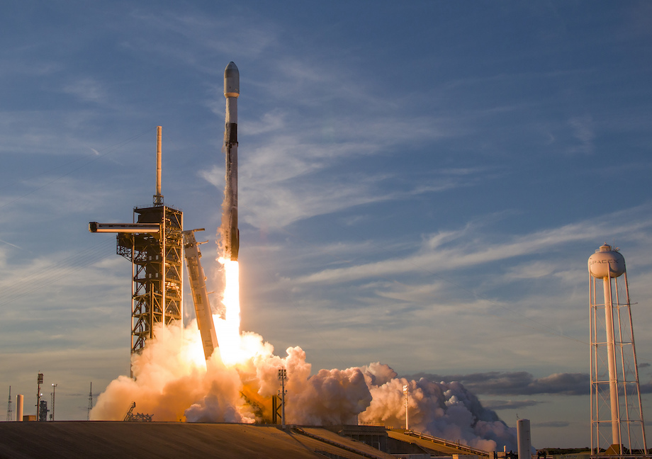
In April 2022, iQPS signed a contract with IHI AEROSPACE Co., Ltd. to entrust the launch of QPS-SAR-3 and -4. These satellites, named AMATERU-I and -II, have the mission of being the first two satellites to form the satellite constellation, and were manufactured based on the development operational results of IZANAGI and IZANAMI, with many improvements. These satellites were launched by Epsilon Launch Vehicle 6 from Uchinoura Space Center in Kagoshima Prefecture at 9:50 on October 12, 2022 (JST). However, after liftoff, as the third stage of the rocket was about to separate, it was found to be deviating from the target attitude, and determined that the satellite could not be inserted into scheduled orbit, so a command destruct signal was sent, and unfortunately the launch failed.
Launched in June 2023QPS-SAR-6 “AMATERU-III”
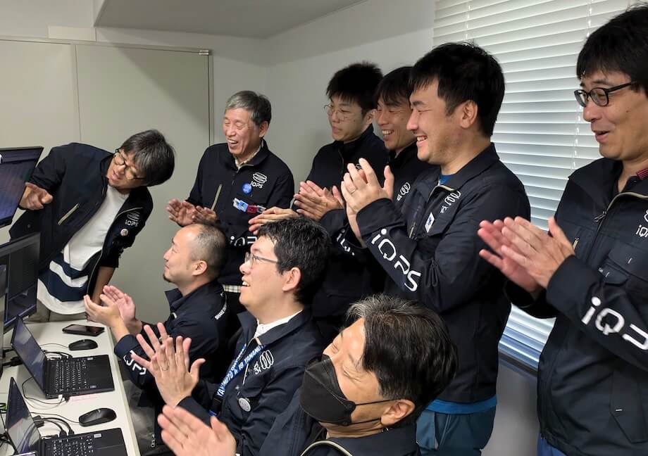
The launch of QPS-SAR-5, that launch was scheduled for January 2023, has been rescheduled due to the circumstances of the contracted launch vehicle company. As a result, the QPS-SAR-6 "AMATERU-III", was launched from Vandenberg Air Force Base by SpaceX Falcon 9 on June 13, 2023 at 6:35a.m. (JST), preceding QPS-SAR-5. After 79 minutes from the launch, AMATERU-III was successfully deployed into orbit at an altitude of approx. 540 km. Around 9:30 a.m. on the same day, the first communication was successfully established, and 21 hours after the launch, the successful deployment of the antenna was confirmed. The series of these news were covered by TV and news outlets throughout Japan.
On July 13, we announced the successful acquisition of the first light (first image), AMATERU-III broke the record for the highest range resolution of a private SAR satellite in Japan, which was held by our QPS-SAR-2 IZANAMI, from 70 cm to 46 cm. (This achievement was attained during normal observation mode, while the azimuth resolution remains consistent with IZANAMI at 1.8m)
And we announced a successful image acquisition in Spotlight Mode (high-resolution mode) on July 25, 12 days after its first light. In the image observed on July 20 over Yokohama, it achieved a remarkable azimuth resolution of 0.46m and a range resolution of 0.39m, marking the highest precision for a private SAR satellite in Japan.
Launched in December 2023QPS-SAR-5 “TSUKUYOMI-I”
Due to the change of the rocket provider, the launch of QPS-SAR-6 took precedence. Following this, we announced a new launch contract with Rocket Lab Inc. for QPS-SAR-5 in August 2023. In line with its nickname “TSUKUYOMI-I” (means deity of Japanese mythology ) the mission's name for the Electron launch was coined as "The Moon God Awakens."
On December 15, 2023, at 13:05 JST, TSUKUYOMI-I was successfully launched from Rocket Lab Launch Complex 1 in New Zealand and injected into orbit at an altitude of approx. 575km, and the first communication was established successfully shortly after. The following morning, on December 16, TSUKUYOMI-I’s antenna was deployed successfully. Then, almost a month after the launch, on January 17, 2024, we proudly announced the successful acquisition of our first light images.
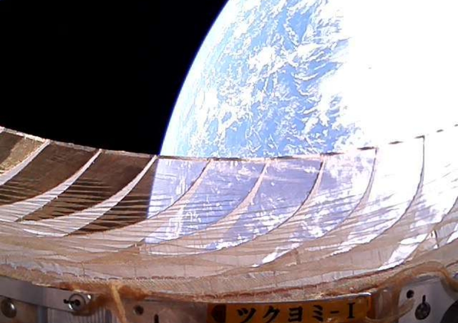
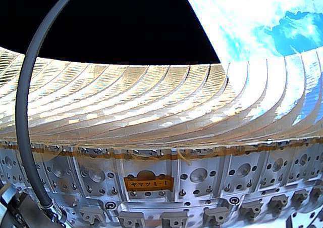
(Taken with a selfie camera mounted on TSUKUYOMI-I)

On February 1, 2024, Tsukuyomi-I became the first commercial QPS-SAR to successfully acquire images in spotlight mode (high-definition mode). In inclined orbit, the world's metropolitan areas in the mid-latitude zone will be observed more frequently than in QPS-SAR AMARERU series (SSO) . Therefore, it is expected to play an even more active role in observing areas of high need.
Launched in February 2024QPS-SAR-7 “TSUKUYOMI-II”
QPS-SAR-7, launched during the inaugural mission of SpaceX's new rideshare service "Bandwagon," which aims to deploy satellites into inclined orbit, has been named "TSUKUYOMI-II," just like the QPS-SAR-5 “TSUKUYOMI-I” that was previously placed in an inclined orbit.
TSUKUYOMI-II was launched by Falcon 9 rocket from Launch Complex 39A at Kennedy Space Center on April 8, 2024, at 8:16 a.m. JST. It was inserted into its planned orbit at 10:02 a.m. JST, made its first communication an hour later, and successfully deployed its antenna late that night.
On May 23, 2024, TSUKUYOMI-II successfully acquired images in Spotlight mode. This success is the third as commercial satellite, and we are making steady progress in expanding our satellite constellation and service offerings while establishing stable initial operational methods.
Launched in August 2024QPS-SAR-8 “AMATERU-IV”
QPS-SAR-8, named "AMATERU-IV," was successfully launched aboard SpaceX's Falcon 9 Transporter-11 mission from Vandenberg Space Force Base's Space Launch Complex 4 at 3:56 AM on August 17, 2024 (JST). It was inserted into a Sun-Synchronous Orbit at 6:32 AM JST. First contact was established approximately two hours later, and antenna deployment was completed by the end of the day.
On September 20, 2024, we released both Stripmap mode and Spotlight mode images as our First Light. Traditionally, we would have spent a week or so adjusting the Stripmap images before releasing Spotlight images but based on our knowledge and experience with the previous satellites, we were able to release both simultaneously for AMATERU-IV.
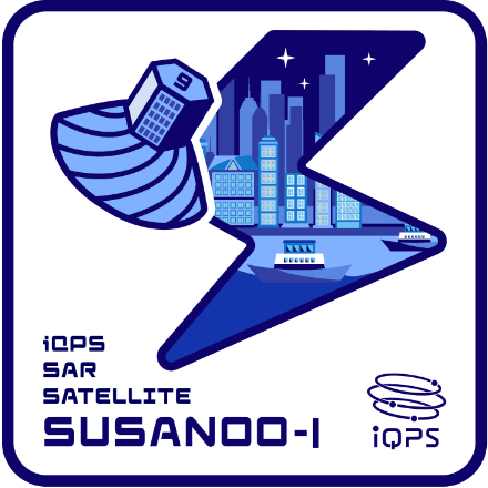
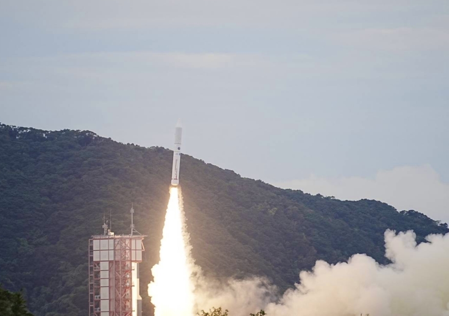
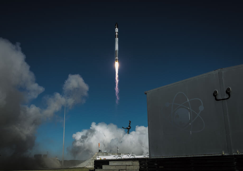
Launched in March 2025QPS-SAR-9 “SUSANOO-I”
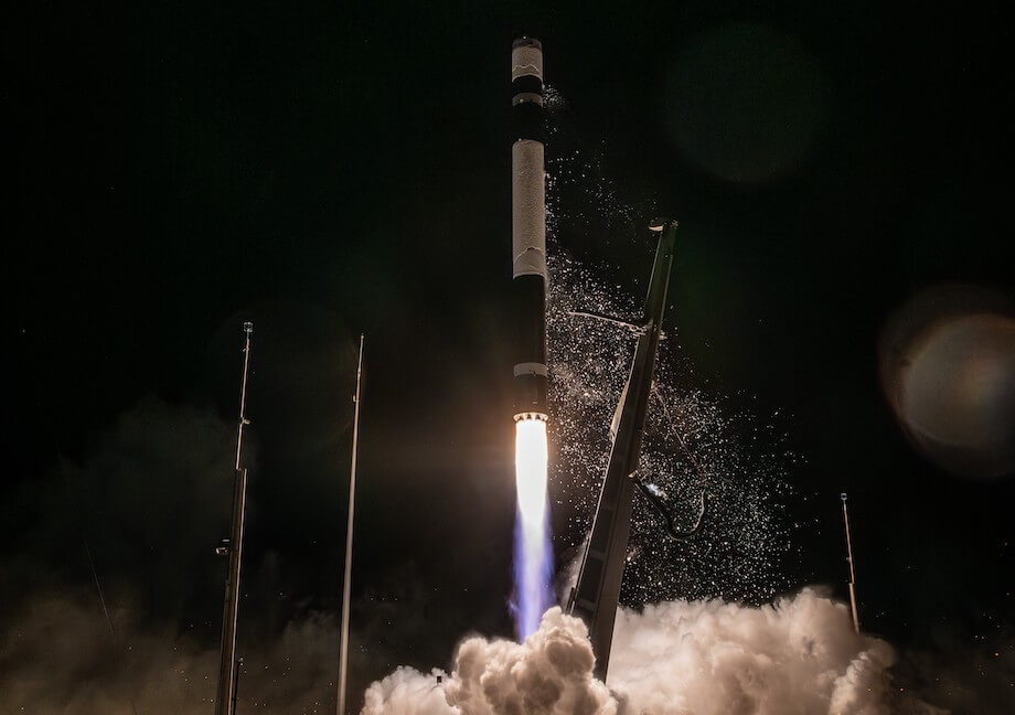
In February 2025, iQPS announced an agreement with US-based Rocket Lab for a total of eight dedicated launches. The first of these launches, QPS-SAR-9 “SUSANOO-I,” lifted off on March 15, 2025, at 9:00 AM JST from Launch Complex 1, Pad B, on New Zealand’s Māhia Peninsula. The Electron mission was aptly named “The Lightning God Reigns” in reference to the satellite’s name, “SUSANOO-I.” “SUSANOO-I” successfully reached its planned orbit at 9:55 AM JST, and approximately 90 minutes later, it established its first communication. By the morning of March 16, 2025, its antenna deployment was successful.
On April 10, 2025, as a first light, we released test observation images in spotlight mode (high-resolution mode). The period from the launch of "SUSANOO-I" to the spotlight observation was about three weeks, achieving efficiency by leveraging past experience.
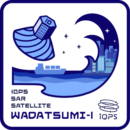
Launched in May 2025QPS-SAR-10 “WADATSUMI-I”
On May 17, 2025, at 5:17 PM JST, QPS-SAR-10, named “WADATSUMI-I,” was successfully launched aboard Rocket Lab’s Electron rocket from Launch Complex 1 on New Zealand’s Māhia Peninsula. Inspired by the satellite’s name – derived from the Japanese sea god Wadatsumi - the launch mission was titled “The Sea God Sees.” Approximately 50 minutes after launch, “WADATSUMI-I” was successfully deployed, and about 30 minutes later, it established the first communication. The following day, on May 18, the satellite successfully deployed its antenna.
On June 9, 2025, we unveiled its first light image, observed in spotlight mode as part of initial operation. The successful operation of WADATSUMI-I, from orbital insertion to the acquisition of its first light, has laid a solid foundation for the satellite constellation that iQPS is striving to build.
Launched in June 2025QPS-SAR-11 “YAMATSUMI-I”
QPS-SAR-11, named "YAMATSUMI-I," was launched under the mission name "The Mountain God Guards" aboard Rocket Lab's Electron from Launch Complex 1 on New Zealand's Māhia Peninsula at 0:31 a.m. on June 12, 2025 JST. Approximately 50 minutes after launch, "YAMATSUMI-I" successfully separated from the Electron, and about 35 minutes later, it achieved its first communication. Furthermore, on the night of the launch day, successfully deployed its antenna.
Test observations began on July 1, 2025, and the first light in spotlight mode was released the following day, July 2. Launching three QPS-SARs and conducting initial operations concurrently over in just four months was a first-of-its-kind endeavor, but we successfully carried it out, marking another step toward building the constellation.
We began trial observations on Tuesday, July 1, 2025, and released our first images the following day, July 2, as our "First Light" captured in Spotlight Mode. It was a challenging period in which we launched three satellites within four months while simultaneously conducting their initial operations. Thanks to careful planning and smooth execution, we successfully advanced toward building our satellite constellation.
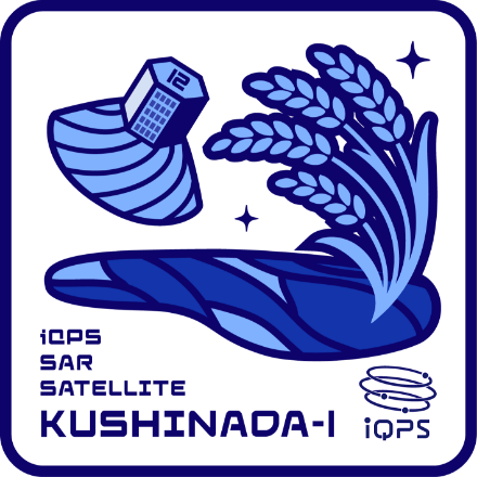
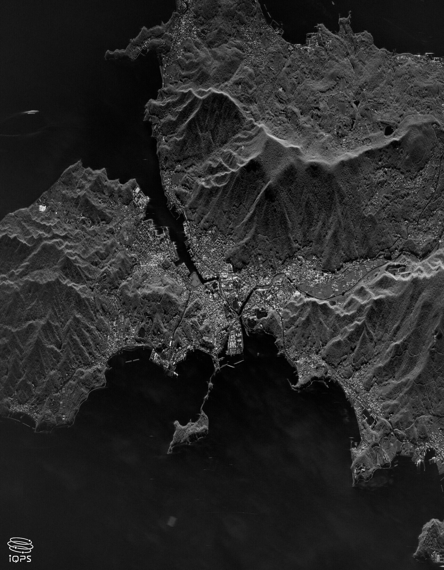
Launched in August 2025QPS-SAR-12 “KUSHINADA-I”
QPS-SAR-12, named “KUSHINADA-I," was launched under the mission name "The Harvest Goddess Thrives" aboard Rocket Lab's Electron from Launch Complex 1 on New Zealand's Māhia Peninsula at 1:10 p.m. on August 5, 2025, JST. Approximately 53 minutes after launch, “KUSHINADA-I" successfully separated from the Electron, and about 30 minutes later, it achieved its first communication. Furthermore, on the evening of the launch day, successfully deployed its antenna.


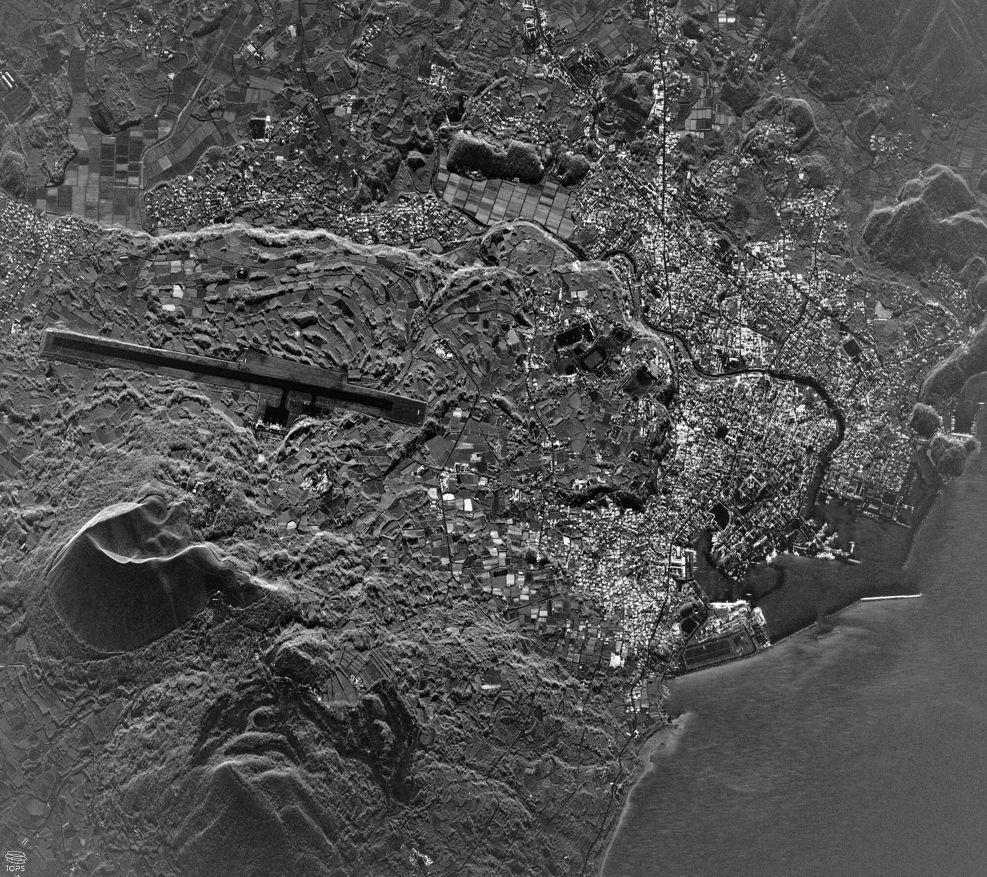
We began trial observations on August 29, 2025, and released our first images September 1, as our "First Light" captured in Spotlight Mode. One of the first images captures the vast expanse of rice fields and farmlands, fitting the nickname KUSHINADA.
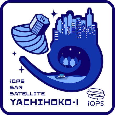
Launched in November 2025QPS-SAR-14 “YACHIHOKO-I”
QPS-SAR-14, named “YACHIHOKO-I,” was launched under the mission name “The Nation God Navigates” aboard Rocket Lab‘s Electron from Launch Complex 1 on New Zealand Māhia Peninsula at 4:51 a.m. on November 6, 2025, JST. Approximately 50 minutes after liftoff, “YACHIHOKO-I” successfully separated from the Electron, and about 35 minutes later, it achieved its first contact. Furthermore, on the morning of the same day, the satellite also successfully deployed its antenna.
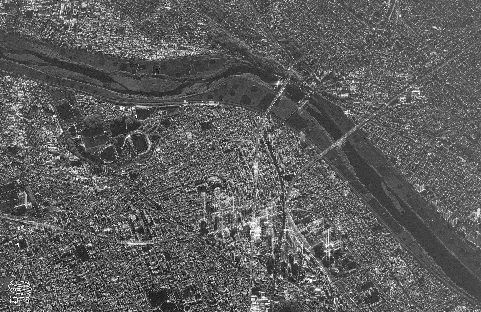
We began trial observations on November 25, 2025, and released our first images November 28, as our "First Light" captured in Spotlight Mode. In the image of Shodoshima, we observed Angel Road, which appears from the sea at low tide.
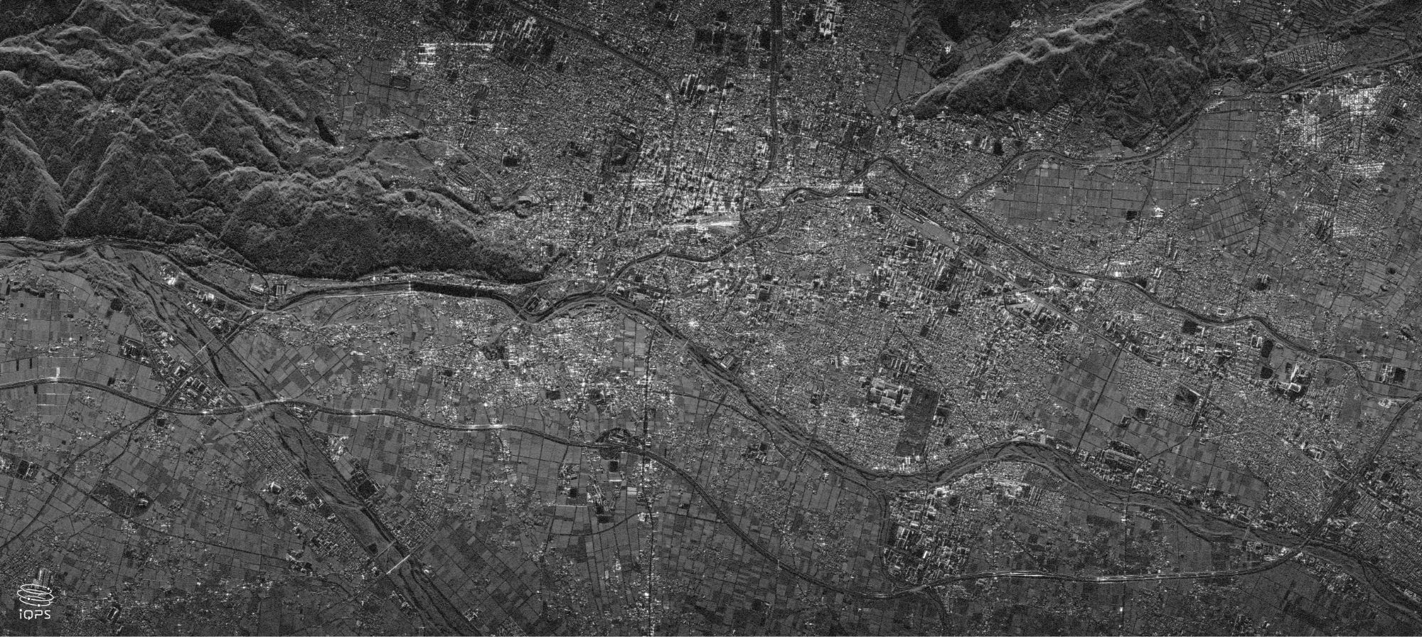
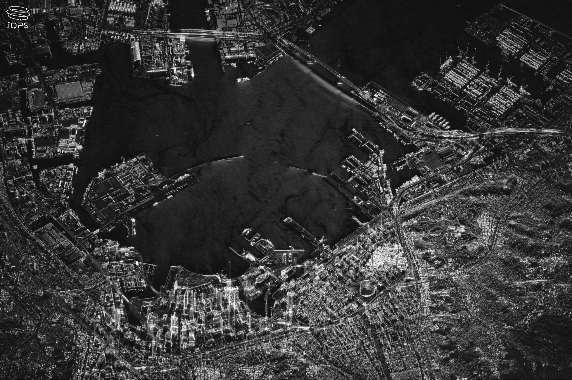
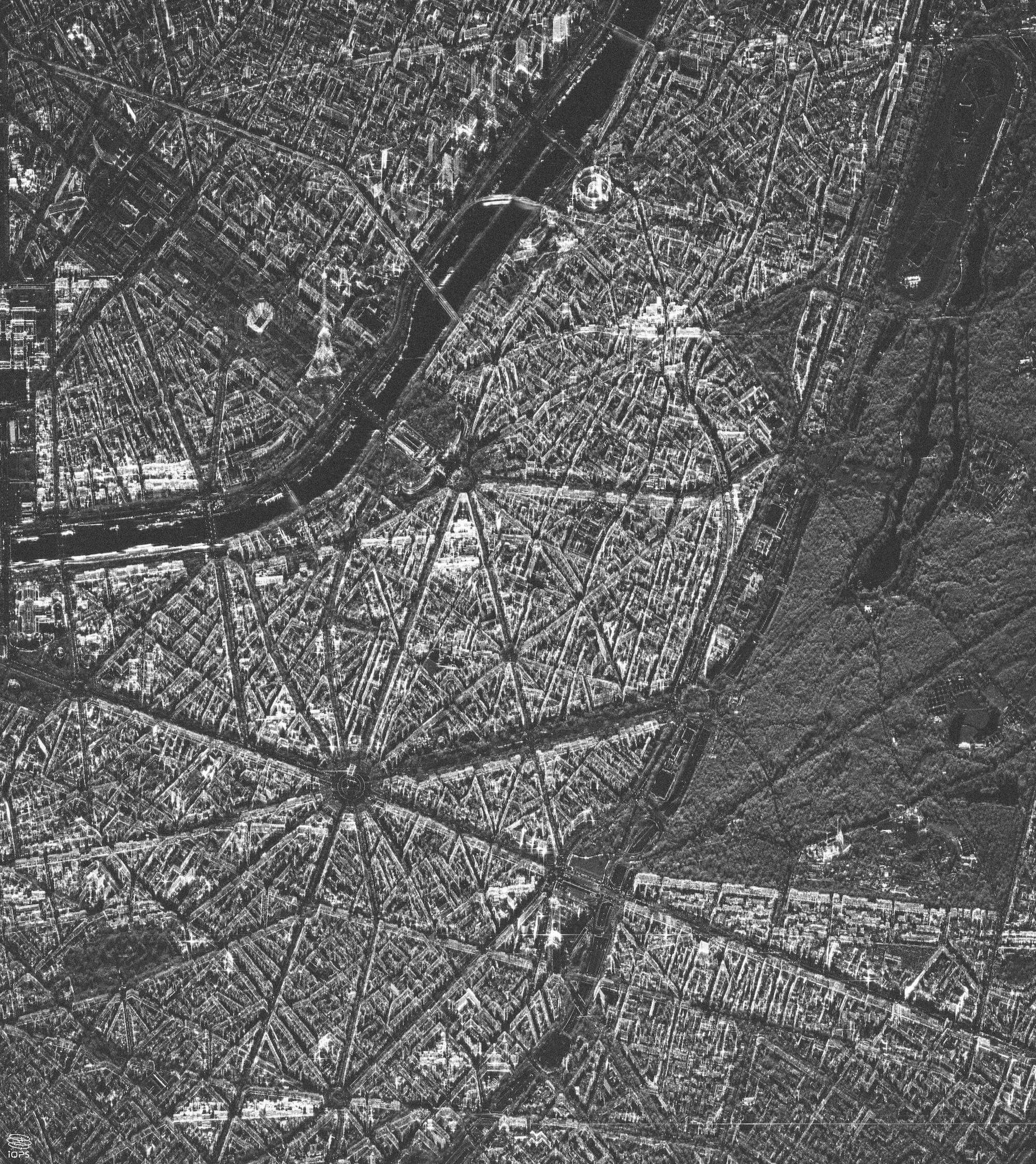
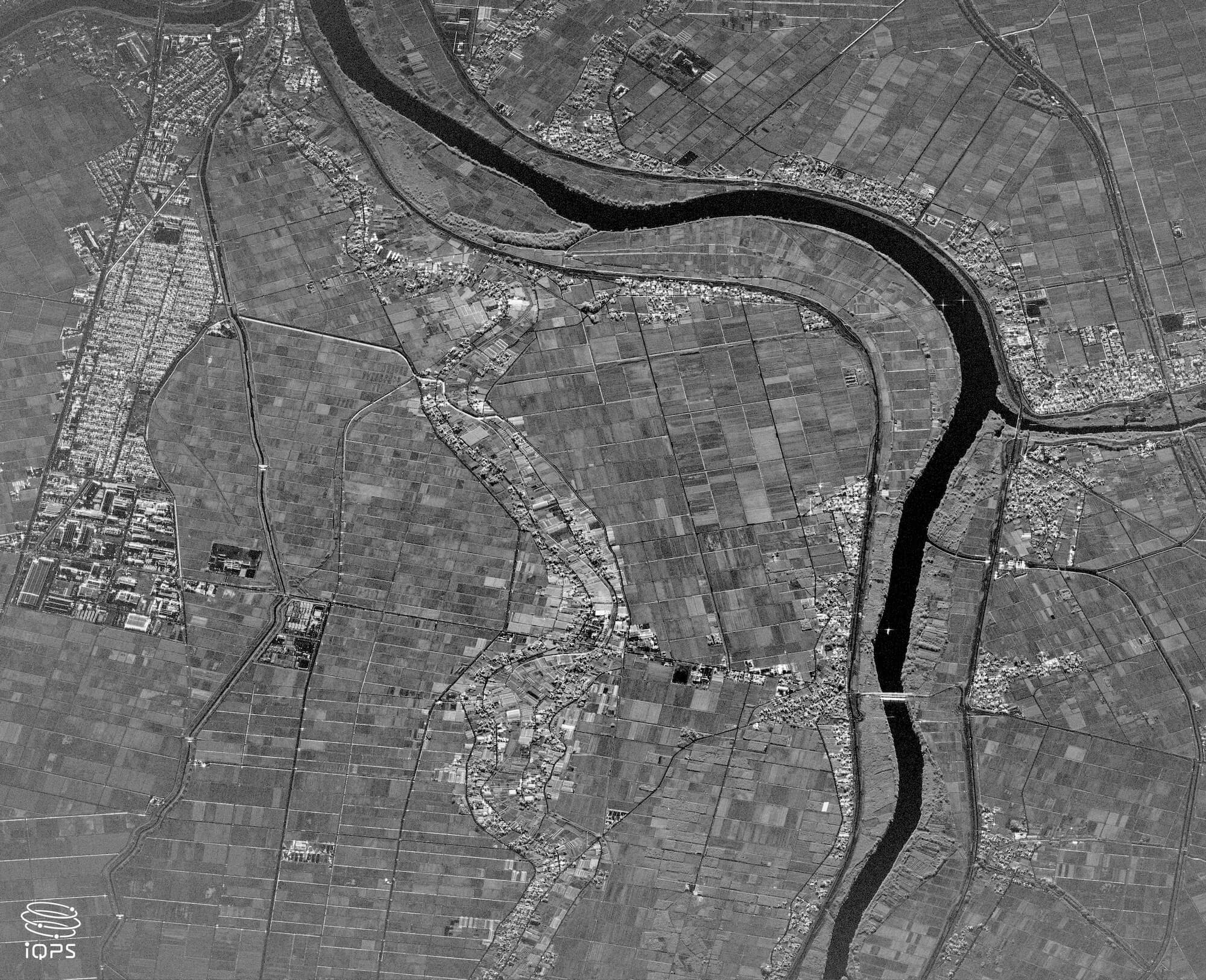
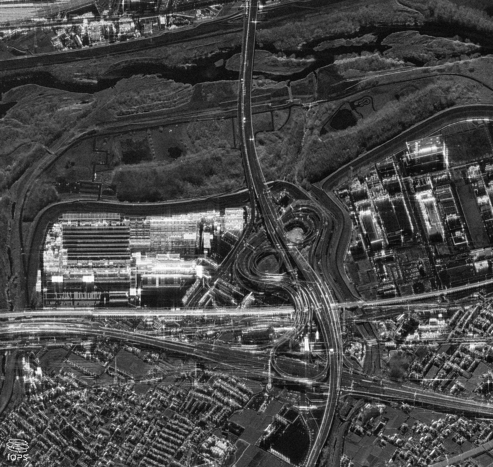
Launched in December 2025QPS-SAR-15 “SUKUNAMI-I”
QPS-SAR-15, named “SUKUNAMI-I," was launched under the mission name "The Wisdom God Guides" aboard Rocket Lab's Electron from Launch Complex 1 on New Zealand's Māhia Peninsula at 3:36 p.m. on December 21, 2025, JST. Approximately 50 minutes after launch, “SUKUNAMI-I" successfully separated from the Electron, and just 6 minutes later, it achieved its first communication. Furthermore, on the morning of the following day, successfully deployed its antenna.

Trial observations commenced on January 22, 2025, with the first light images released the following day.
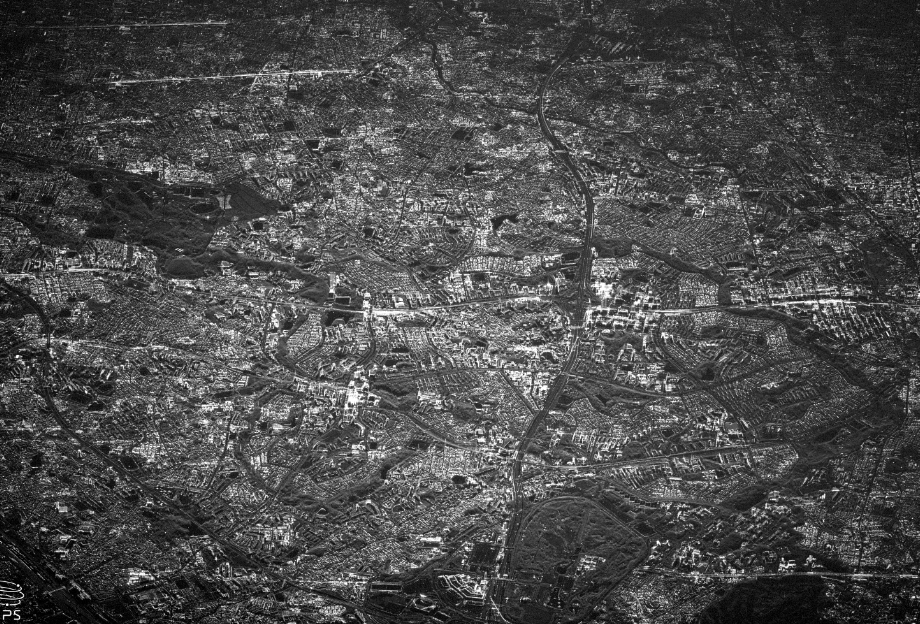
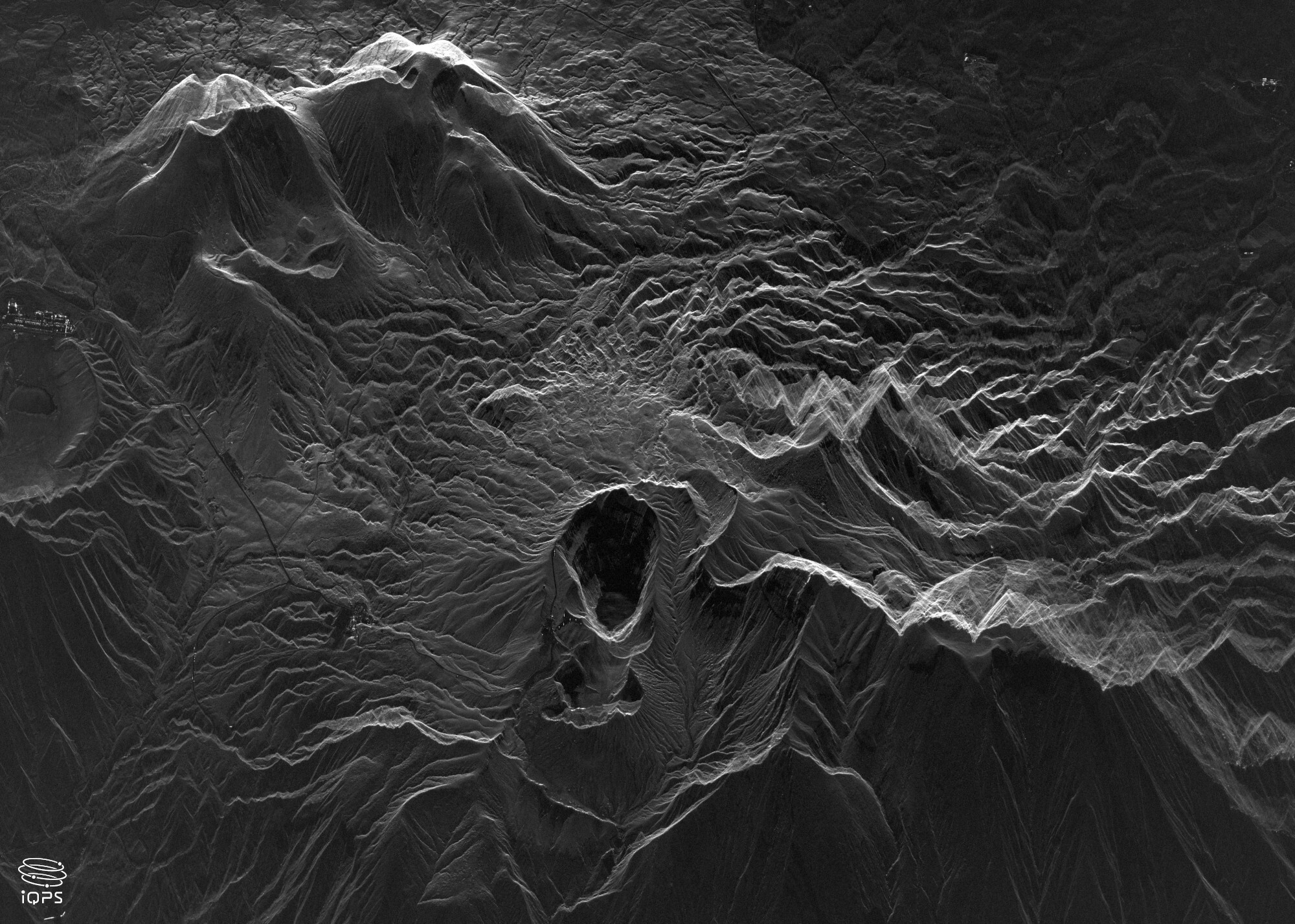
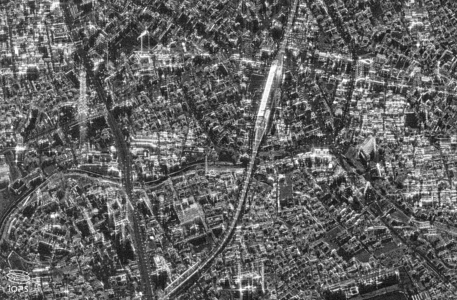
The imagery of Oyamazaki Town demonstrates exceptional clarity, revealing the intricate structure of the interchange in striking detail.
Ideas that lead the future, numerous inventions propelling the space industry forward
iQPS’s highly-acclaimed technological strengths and development capabilities to realize small SAR satellite.
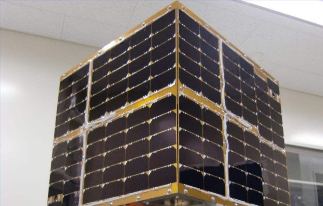
Small Satellite
Only a few Japanese companies are capable of developing, designing, manufacturing, and launching (arrangement) small satellites on their own, and iQPS is one of them. Our design and development capabilities and sophisticated space equipment manufacturing techniques brought by the network of highly skilled local companies in Kyushu are widely acclaimed.
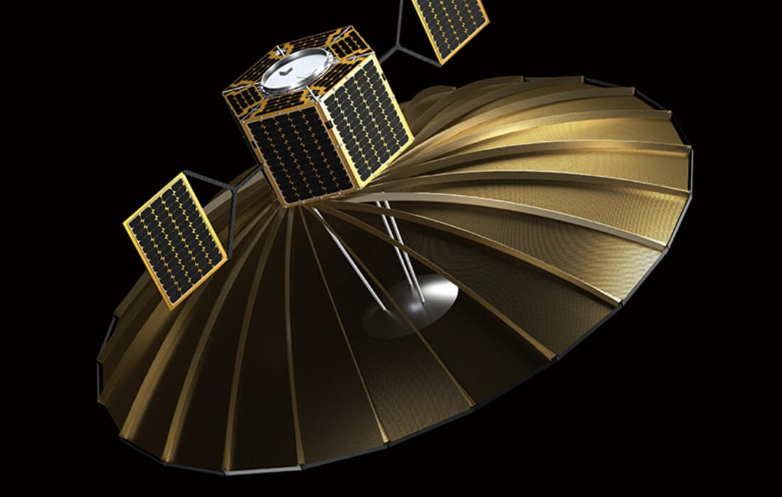
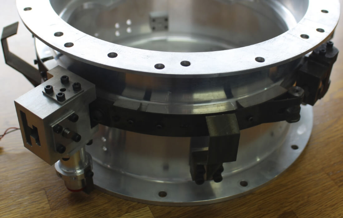
Large and ultra-lightweight antenna
for 100kg-class small satellite
3.6m diameter large deployable parabolic antenna with only 10kg of weight. We have received inquiries from overseas space agencies, Japanese universities, and the world’s leading companies in the space industry for potential trade and development. We are also attracting the attention of both domestic and overseas investors for the technology and high usability.
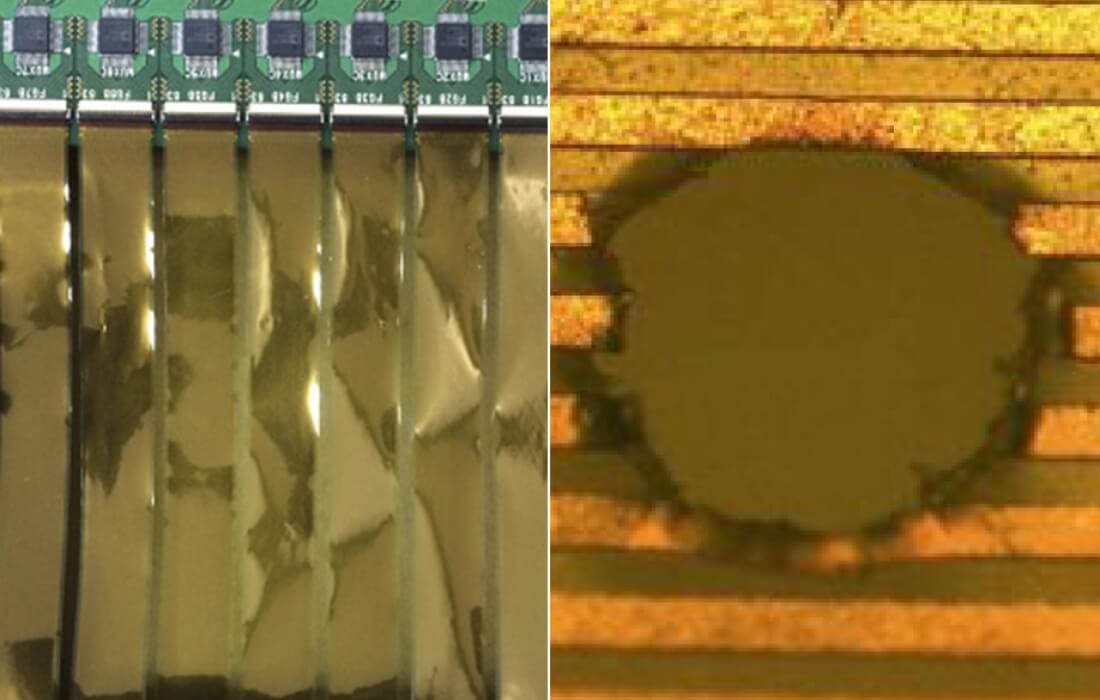
Debris sensor
This is a device to measure the space debris drifting in the space. We were the first to develop the debris sensor mechanism utilized for debris observation of space agencies and venture entities. Many more applications are expected in the growing debris management and debris reduction markets.
* Jointly developed with IHI Corporation (Patented)
“Good inventions often come from simple ideas.”
“We were working on space debris research in Japan to keep up with other countries, but around 2006, when iQPS was just starting, we noticed a significant difference in the density of debris smaller than 1mm compared to the announcements between the United States and Europe. We wanted to figure out which one is actually true because each estimation method was different, you know? Even tiny debris, like grains of sand, can cause damage to satellites when they collide. So, examining these small debris is crucial in space development.
Well, when I was thinking about how to investigate it, our co-founder, Mr. Sakurai, suddenly said, 'Why not lay down thin wires with electricity flowing through them on a substrate? When the tiny debris collides, the wires will be physically cut, and the electricity will be interrupted, allowing us to know, right?'
And we can determine the size of the debris from the number of wires cut. The principle is simple, so I thought someone might have already done something like that before, and I checked, but surprisingly, no one had. So, we decided to give it a shot and made a prototype.
It seemed like it worked on one of the attempts, but when we actually applied electricity to it, there was no conductivity. Because it's a small component, there was a hurdle there. After going through several prototypes, we managed to create something that seemed usable, so we decided to put it on a satellite to demonstrate it.
Overseas, there are various developments to examine micro debris. They've got techy stuff like devices that detect the pulse waves when debris hits or ones that use triangulation principles. But I believe that the simpler the principle, the more practical it can be.
This development that was born from inspiration has been subsequently put into practical use and utilized in research.”
(By Tetsuo Yasaka, Founder of iQPS)
Non-pyro type satellite
separation mechanism
Satellite separation mechanism is a device that separates rocket and satellite. The impact level can be reduced to a small fraction of the conventional method if pyro is not used for the separation; therefore, it can offer a big advantage to satellite manufacturers and satellite operators because they can relax the durability required for the satellite. In addition, since it is not broken every time and can be reused unlike the pyro type system, it is an innovative product especially for testing purpose. Various space industry-related companies including the world’s leading companies in the space industry are showing interest in dealing with us. * Jointly developed with Nakashimada Engineering Works, Ltd.
* Jointly developed with Nakashimada Engineering Works, Ltd.
Throughout the history of space exploration,
"Separation" has been a continuous series of failures.
“Back in the day when I was involved in rocket development, the "separation" mechanism was always a challenge and a series of failures. Originally, we used explosive for rocket engine separation, and we had to adjust the amount while working on it.
After that, I started using the Marman clamp method, which reduced the amount of explosive used, but even then, there were still blasts and the cost was quite high. Moreover, there were strict legal regulations, making the management quite challenging.
While conducting research on small satellites at university, I also started developing the satellite separation mechanism. Around the late 1990s, I began exploring methods that didn't involve using explosive and gradually improved the design.
The final product yielded great results, and the cost was reduced to about one-fifth of what it used to be. In this age where sustainability is highly valued, space development also needs to shift towards reusability. Otherwise, we wouldn't be able to be real sustainable.”
(By Tetsuo Yasaka, Founder of iQPS)
Electrodynamic Tether (EDT)
The string-like device that produces a current using the induced electromotive force and moves up and down by the Lorentz force generated by the interference between the electric current and the geomagnetic field of the earth. It was widely reported that demonstration experiment of electrodynamic “tether” was conducted by JAXA on the H-II Transfer Vehicle “KOUNOTORI 6” (HTV 6) separated from the International Space Station on January 28, 2017, as the first step to implement a space debris removal system. Making good use of the accumulated knowledge of tether satellite study in Kyushu University since early period, we designed the initial system of satellite for JAXA’s electrodynamic tether demonstration experiment and developed the control unit for the experiment equipment.
“This is a fascinating research topic that I love."
“Multiple satellites connected in space, it's called "Tethered satellites" and its system called s "Tether system." When you connect satellites with a tether, you can do all sorts of research.
Like stabilizing the attitude, transporting between orbits, generating power or propulsion, changing orbits, and so on. It all started as a hobby when I was into fishing. I saw an extending fishing rod and that's what sparked the idea for this system.
Especially if we create a tether system for geostationary satellites, it would be amazing, I think. However, there's also a risk of it getting cut by debris (which is why I started researching debris as well). To address this, we could use two tethers, and maybe add plenty of knots along the way, so even if one breaks, the impact would be minimal. There's still plenty of room for improvement, you know?”
(By Tetsuo Yasaka, Founder of iQPS)
Controllable Drag Augmentation Device (De-orbit Device)
This is a device to prevent small satellites from becoming debris. While other devices that prevent forming debris are basically “one-time-only usage” (once it is opened or deployed, it can never close or shrink), our controllable de-orbit device distinguishes itself by being able to open/deploy and close/shrink freely, and thus reusable and re-adjustable.
* Jointly developed with Ryokeiso Corp.